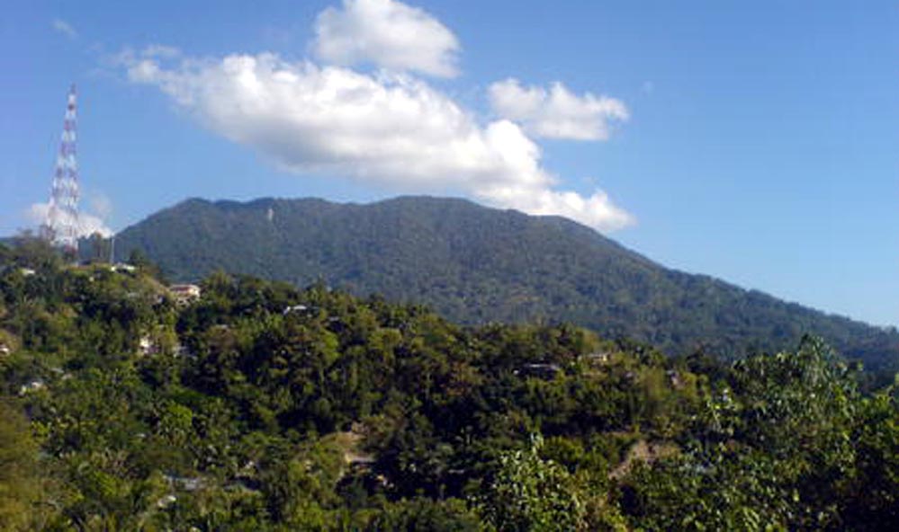
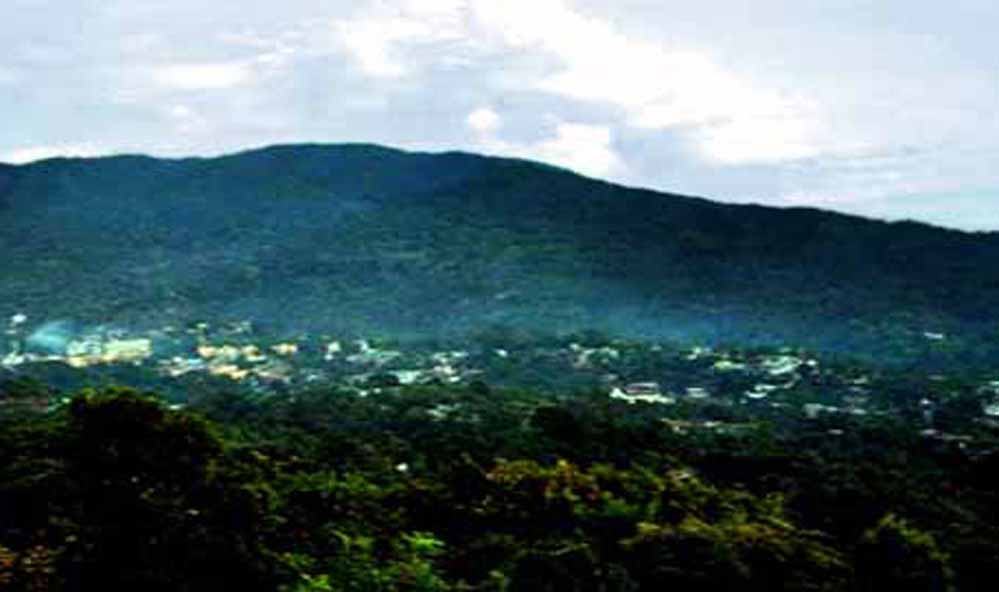
TURA, West Garo Hills — Five kilometers separate downtown Tura from the summit of Tura Peak, but those five kilometers traverse worlds. The trail begins near Akonngre on the town's eastern edge, where paved roads give way to forest paths and the sounds of traffic fade beneath hornbill calls and gibbon chatter (Meghalaya Tourism, 2026).
At 872 meters above sea level, Tura Peak stands as the accessible face of the Garo Hills—close enough for an afternoon excursion, yet wild enough to deliver genuine mountain solitude (Shillong.com, 2026; Wikipedia, 2026). Local legend holds that the peak provides a sacred abode for spirits, making it a site of reverence for Garo communities who have lived in its shadow for generations (West Garo Hills District Administration, 2025).
For visitors to West Garo Hills, Tura Peak serves as both introduction and invitation: a manageable trek that hints at the wilder adventures—Nokrek's red pandas, Balpakram's spirit gorges, Siju's bat-filled caves—waiting deeper in the hills.
THE CLIMB: A MODERATE CHALLENGE WITH RICH REWARDS
The standard route to Tura Peak's summit covers approximately 5 kilometers one-way, beginning from DC's Park or the Akonngre trailhead on Tura's eastern outskirts (TripAdvisor, 2026; Meghalaya Tourism, 2026). Most trekkers complete the ascent in 45 minutes to 1.5 hours, depending on fitness level and pace (TripAdvisor, 2026).
As one visitor described the experience:
"I had climbed this mountain twice. It is a massive mountain. Indeed tiresome, but after reaching there, feels pleasant, good breeze and good to look around" (TripAdvisor, 2026).
The trail difficulty rates as moderate—steep sections require steady footing, but no technical climbing or special equipment beyond sturdy footwear. The path winds through what the West Garo Hills District Administration (2025) describes as "bluish-green tropical deciduous vegetation," transitioning from secondary forest near town to denser primary forest approaching the summit.
AllTrails (2026) classifies the route as "generally considered a challenging route" at 5.0 miles out-and-back, noting its popularity for birding, hiking, and running. Wildlife encounters are common: hornbills (including great hornbills and wreathed hornbills), Western hoolock gibbons, barking deer, and diverse butterflies inhabit the peak's forests (Meghalaya Tourism, 2026; Meghtourism Facebook, 2024).
A social media post from May 2024 captured the biodiversity appeal:
"Hike through the lush forests of Tura Peak, teeming with exotic birds, including majestic hornbills, and witness the playful antics of gibbons" (Meghtourism Facebook, 2024).
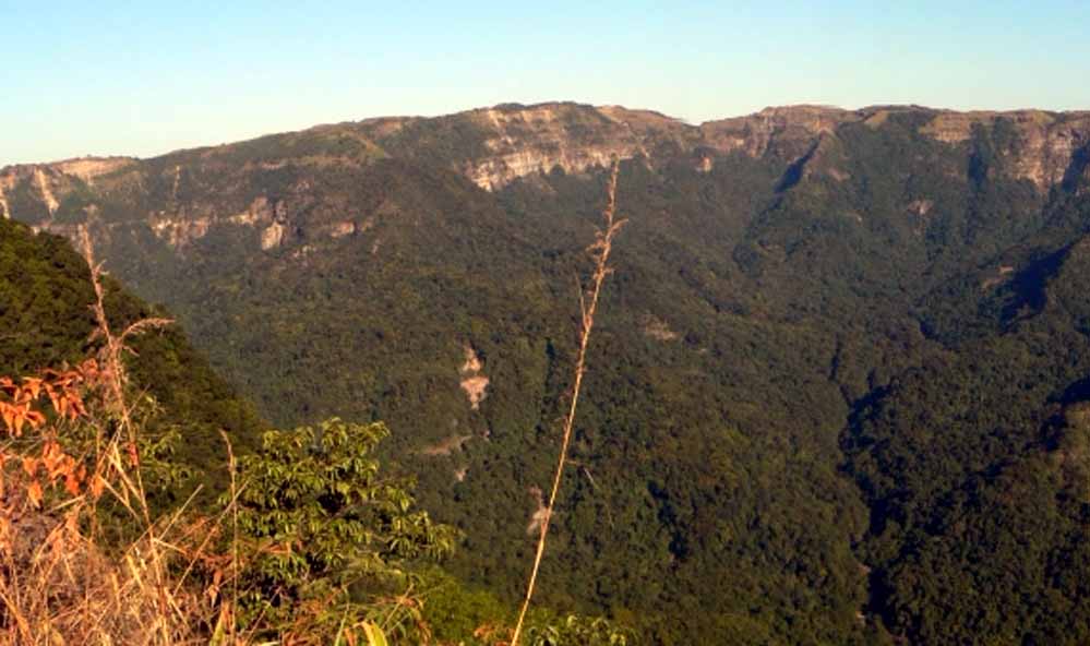
THE SUMMIT VIEW: 360 DEGREES OF GARO MAJESTY
From Tura Peak's forested summit, the view encompasses:
- To the south and west: The Garo Hills rolling toward Bangladesh, with golden plains visible on exceptionally clear days (Assam Holidays, 2026)
- To the north: The Brahmaputra Valley stretching across Assam (Assam Holidays, 2026)
- To the east: On rare crystal-clear winter mornings, the distant Himalayas emerge on the horizon (Assam Holidays, 2026)
Sunrise and sunset transform the panorama into what visitors describe in reverent terms:
"The view from peak is almost same like other peaks, but here hardly any crowd. only the sound of wind. Close your eyes and stand for some time, you will feel the solitude" (TripAdvisor, 2026).
A YouTube video from January 2021 documents a New Year's Day trek, with participants noting: "It was a good track i think it just doesn't take much yeah it just needs energy enthusiasm" (YouTube, 2021). The video showcases the relatively accessible nature of the climb compared to more remote Garo Hills destinations.
An Instagram reel posted in 2024 captured the emotional pull:
"I couldn't stop myself from re-visiting this place. I can come back here another 100 times" (Instagram, 2024).
PRACTICAL INFORMATION: PLANNING YOUR TURA PEAK TREK
Best Time to Visit
October to April offers optimal conditions: clear skies, comfortable temperatures (12-25°C), and minimal rain (Meghalaya Tourism, 2026; MyIndianProducts, 2026).
March to June provides warmer weather (16-30°C) and is considered peak tourist season (TripCrafters, 2026; WanderOn, 2024). Spring brings flowering orchids and migratory birds.
Monsoon (June-September) makes the trail slippery and muddy, with leeches proliferating and visibility often reduced by fog. However, the forest is at its greenest during this period.
Getting There
From Tura Town:
- Distance: 5 km
- Options: Trek (2-3 hours round trip), taxi (₹300-500 return with waiting time)
- Trailhead: DC's Park or Akonngre; clearly marked
Reaching Tura:
- By Air: Guwahati Airport (220 km; 5-6 hours by road); helicopter service available (limited schedule)
- By Rail: Guwahati Railway Station (230 km); hire taxi or board shared sumo/bus to Tura
- By Road from Shillong: 121 km via NH62 (4-5 hours); shared taxis available
- By Road from Guwahati: 219 km via NH217 (5-6 hours); buses and shared vehicles frequent
Accommodation in Tura
Budget (₹800-1,500/night):
- Hotel Rikman Continental (Circular Road)
- Basic lodges near main market
Mid-Range (₹1,500-3,000/night):
- Hotel Polo Tura
- Hotel Orchid
- Hotel Regal
Government:
- Circuit House (officials priority; advance booking required)
What to Bring
- Sturdy hiking shoes with good grip
- Water (1-2 liters; no sources on trail)
- Sun protection (hat, sunscreen)
- Insect repellent (especially March-October)
- Snacks/energy bars
- Light rain jacket (weather can change quickly)
- Camera/binoculars for wildlife
- Small first aid kit
Fees and Regulations
- No entry fee (as of 2026)
- No permit required for peak trek
- Guides not mandatory but available (₹300-500) through hotels or DC's Park
- Respect local customs; avoid loud noise near summit (considered sacred)
TURA PEAK AS BASE CAMP: GATEWAY TO GREATER ADVENTURES
Tura Peak's greatest value may be as appetizer rather than main course—a warm-up trek that prepares visitors for the Garo Hills' more demanding adventures:
Nokrek National Park (45 km from Tura)
- UNESCO Biosphere Reserve
- Home to Citrus indica (wild orange progenitor)
- Red pandas at subtropical elevations
- Summit trek: 16-18 km, 5-6 hours
- Moderate to strenuous difficulty
Balpakram National Park (167 km from Tura via Baghmara)
- "Land of Spirits" in Garo mythology
- Dramatic canyon system
- Red pandas, Asian elephants, clouded leopards
- Carnivorous pitcher plants
- 2-3 day expedition
Siju Cave (Dobakhol) (117 km from Tura)
- India's third-longest cave (4+ km explored)
- Tens of thousands of bats
- Underground rivers and limestone formations
- 2-3 hour guided exploration
Pelga Falls (50 km from Tura)
- Seasonal waterfall (best July-September)
- Swimming possible in pools
- Day trip; accessible by vehicle
VISITOR PERSPECTIVES: SOCIAL MEDIA & REVIEWS
Recent visitor testimonials reveal consistent themes of solitude, natural beauty, and manageable challenge:
TripAdvisor Review (2024):
"The Tura Peak, which is about 5 kms trekking distance from the town, is a nature lover's delight. Beneath it's bluish-green tropical deciduous vegetation are numerous varieties of mammals, birds and reptiles, and the cool mountain air offers respite from the heat of the plains" (TripAdvisor, 2026).
YouTube Trek Documentation (2021): Started 2021 with a trek to Tura Peak on January 2nd. Height: 872 m above sea level. Distance: 5 km from Tura town. The video notes the relatively accessible nature of the climb compared to Nokrek Peak, making it suitable for casual trekkers and families (YouTube, 2021).
Instagram Engagement (2024): Multiple Instagram posts from 2024 showcase sunset views from the summit, with captions emphasizing the "off-the-beaten-path" appeal and lack of crowds compared to Meghalaya's more famous peaks like Shillong Peak (Instagram, 2024).
AllTrails User Data (2026): The trail maintains a consistent rating with users noting:
- Great for birding (hornbills, woodpeckers, kingfishers)
- Moderate difficulty suitable for fit beginners
- Best tackled in morning (summit by 9-10 AM) or late afternoon for sunset
- Limited signage in upper sections; locals helpful for directions
THE VERDICT: FOR WHOM IS TURA PEAK?
Tura Peak occupies a unique niche in the Garo Hills trekking spectrum: accessible enough for casual hikers, wild enough to feel like an adventure, close enough to Tura town for spontaneous afternoon excursions.
Ideal For:
- First-time trekkers testing their fitness before tackling Nokrek or Balpakram
- Families with older children (10+ years with reasonable fitness)
- Nature photographers seeking wildlife and panoramic views
- Time-constrained visitors with only a few hours in Tura
- Solo travelers wanting a safe, well-marked route
- Birdwatchers and wildlife enthusiasts
Not Ideal For:
- Those seeking total wilderness isolation (proximity to town means occasional trail traffic)
- Visitors with mobility limitations (steep sections, no vehicle access to summit)
- Thrill-seekers wanting technical climbing or extreme challenge
- Travelers expecting developed infrastructure (no facilities on trail or summit)
As Ghoomein.co.in (2026) summarizes: "Tura Peak is one of the best scenic viewpoints around the city, giving wide hill-and-forest views that feel distinctly Garo Hills."
In an era when many Indian hill stations suffer from overdevelopment and crowds, Tura Peak retains a refreshing simplicity: a forest trail, a summit clearing, a view across the hills, and the wind that has blown across these ridges for millennia.
ESSENTIAL INFORMATION
| Category | Details |
|---|---|
| Location | Eastern edge of Tura town, West Garo Hills, Meghalaya |
| Elevation | 872 meters (2,861 feet) above sea level |
| Distance from Town | 5 km (one-way) |
| Trek Duration | 45 min–1.5 hours ascent; 30 min–1 hour descent |
| Trail Difficulty | Moderate (steep sections but no technical climbing) |
| Best Time | October–April (March–June peak season) |
| Entry Fee | None (as of 2026) |
| Permit Required | No |
| Guide Needed | No (optional; ₹300-500 if desired) |
| Nearest Airport | Guwahati (220 km) |
| Nearest Railway | Guwahati (230 km) |
| Accommodation | Tura town (₹800-3,000/night range) |
| Mobile Reception | Good near trailhead; intermittent on upper trail |
| Wildlife | Hornbills, gibbons, barking deer, butterflies |
| Facilities | None on trail/summit; bring all supplies |
Nearby Attractions from Tura
- Nokrek National Park: 45 km
- Balpakram National Park: 167 km (via Baghmara)
- Siju Cave: 117 km
- Pelga Falls: 50 km
Contact Information
- West Garo Hills Tourism Office: Tura town
- Meghalaya Tourism: www.meghalayatourism.in
- Emergency: Tura Civil Hospital: +91-3651-222230
REFERENCES
AllTrails. (2026, January 9). Tura Peak, Meghalaya, India - Map, guide. https://www.alltrails.com/trail/india/meghalaya/tura-peak
Assam Holidays. (2026). Tura Peak – Places to visit in Meghalaya. https://assamholidays.com/tura-peak-places-to-visit-in-meghalaya/
Ghoomein.co.in. (2026). Tura Peak – Viewpoint above Garo Hills town. https://ghoomein.co.in/places/tura-peak/
Instagram. (2024). Do you agree? In the frame - Foothills of Tura Peak [Social media post]. https://www.instagram.com/reel/C68kHGjvIBJ/
Meghalaya Tourism. (2026). Tura Peak. Government of Meghalaya. https://www.meghalayatourism.in/explore/destinations/by-interest/viewpoints-&-peaks/tura-peak/
Meghtourism. (2024, May 7). Hike through the lush forests of Tura Peak [Facebook post]. https://www.facebook.com/Meghtourism/posts/981145300040545/
MyIndianProducts. (2026). Tura Peak. Travel Directory of India. https://www.myindianproducts.com/travel/place/Tura__Peak/721
Shillong.com. (2026). TURA PEAK Tura, West Garo Hills, Meghalaya. https://www.shillong.com/node/118
Travafa. (2026). Plan trip to Tura | Travel to Tura | Experience Tura. https://travafa.com/location/turameghalayaindia
TripAdvisor. (2026). Tura Peak (2026) - All you need to know before you go. https://www.tripadvisor.com/Attraction_Review-g1591396-d3244143-Reviews-Tura_Peak-Tura_West_Garo_Hills_District_Meghalaya.html
TripCrafters. (2026). Tura tourism and travel guide (2026). https://www.tripcrafters.com/travel/tura-tourism-and-travel-guide
WanderOn. (2024, August 3). Tura Peak: Attractions, activities, trip | Best travel guide. https://wanderon.in/blogs/tura-peak-meghalaya
West Garo Hills District Administration. (2025, December 8). Places of interest. Government of Meghalaya. https://westgarohills.gov.in/places-of-interest/
Wikipedia. (2026). Garo Hills. https://en.wikipedia.org/wiki/Garo_Hills
YouTube. (2021, February 13). Tura Peak | Exploring Garo Hills | North East Meghalaya [Video]. https://www.youtube.com/watch?v=Pxir-T4MKKk
This article was researched and written in January 2026 with reference to government tourism sources, visitor reviews, social media documentation, and travel guides. Field conditions and facilities may change; verify current information before travel.